

Salt River Guide Book
Salt River Guide Book
Regular price
$29.95
Regular price
$0.00
Sale price
$29.95
Unit price
per
Media Mail: $4.00/order
SKU: 74072
Out of stock, call to pre-order
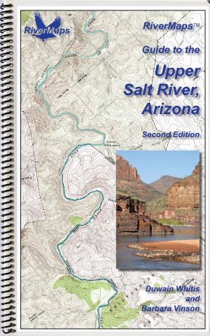
The RiverMaps Guide to the Upper Salt River guidebook in the Salt River Canyon Wilderness, Arizona, covers 53 river miles from the put-in at Hwy 60 bridge to the take-out at Hwy 288.
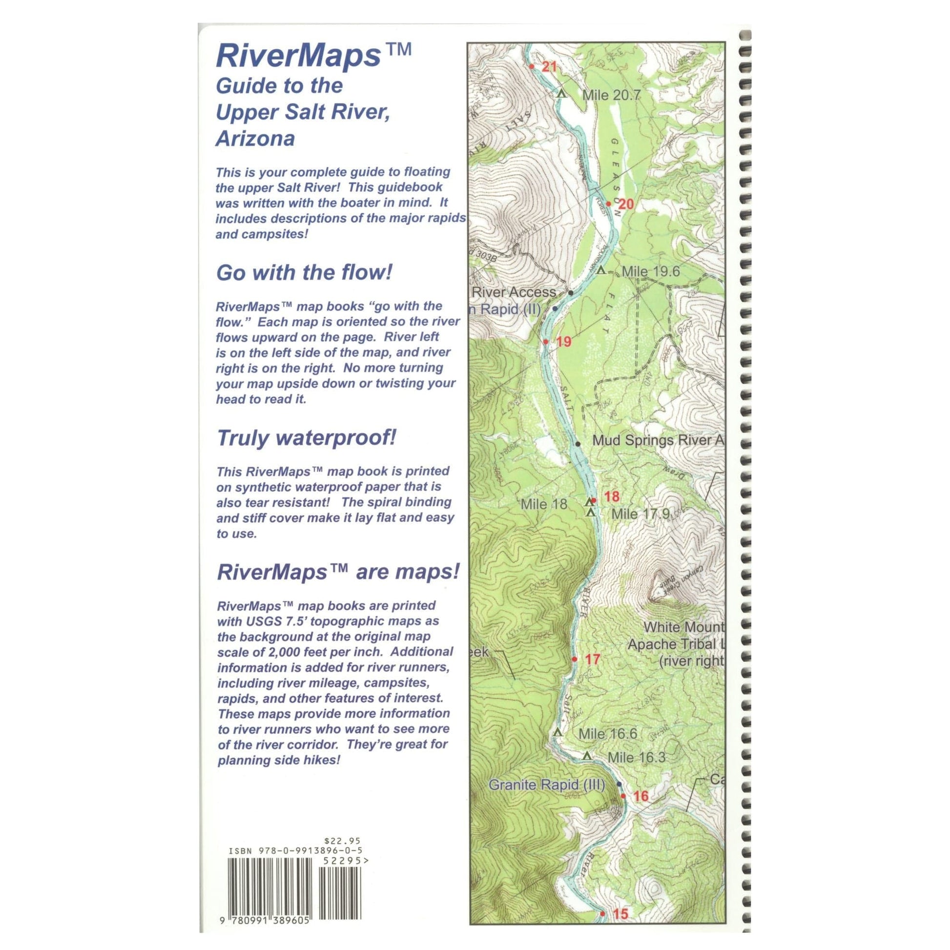
- "Go with the flow" map orientation for easy reading and downstream interpretation
- USGS topographic map backgrounds, printed at their original scale, with additional map detail added in an easy-to-read format
- Spiral-bound, waterproof, topographical river map printed on plastic card stock pages
- Each map shows campsite locations, rapids, scout points, river miles and other points of interest, and include many photographs
- Mile-by-mile information ranging from archeological history to geologic surroundings to potential side hikes
- Guidebook includes General Information and other sections including river info, permit and regulations, geology, archeology and history, and plants and animals
- 9" x 14"
- Second Edition, Copyright 2014, 28 total pages, 7 maps
Bonus: If the map gets wet, don't worry! It can stay wet without damage. The pages usually won't stick but you may need to air dry each page or wipe with a dry rag. You can write on dry plastic pages with an indelible marker. Entire guidebook is waterproof and tear resistant but not indestructible.
- 28 pages with 7 maps
- 53 miles
- color photographs, and shaded topographic relief
- Copyright 2014
- 9"x14"

