
Middle Fork & Main Salmon River Guide
Middle Fork & Main Salmon River Guide
12 in stock
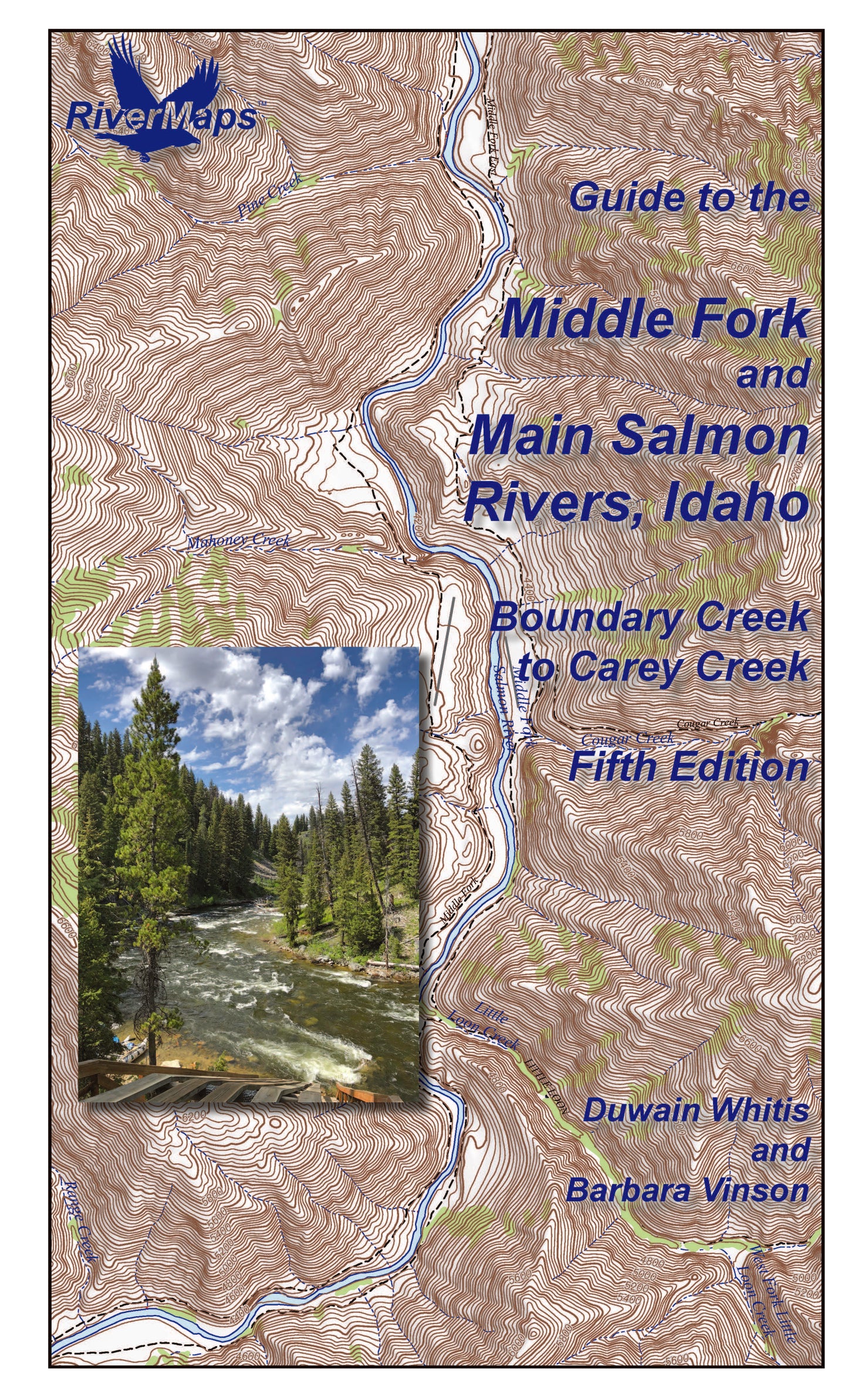
The RiverMaps Guide to the Middle Fork and Main Salmon Rivers is the must-have guidebook for your Idaho Salmon River trip. This guidebook covers 184 river miles of the permitted sections of both the Middle Fork and the Main Salmon from Boundary Creek on the Middle, to the Carey Creek take-out on the Main.
- "Go with the flow" map orientation for easy reading and downstream interpretation
- USGS topographic map backgrounds, printed at their original scale, with additional map detail added in an easy-to-read format
- Spiral-bound, waterproof, topographical river map printed on plastic card stock pages
- Each map shows campsite locations, rapids, scout points, river miles and other points of interest, and include many photographs
- Mile-by-mile information ranging from archeological history to geologic surroundings to potential side hikes
- Guidebook includes General Information and other sections including river info, permit and regulations, geology, archeology and history, and plants and animals
- 9" x 14"
- Fifth Edition, Copyright 2025, 76 total pages, 32 maps
Errata & Revisions
Severe debris flows occurred in August of 2022 and 2023 following heavy rains on fire denuded slopes, altering the river significantly between miles 2.9 and 5.2. Please note the following revisions, which will be incorporated in the next printing:
MAP 1:
Mile 4.6 – A long rapid known variously as Hells Half Mile, Second Slide, or Second Narrows Rapid extends for most of the next quarter mile through a bedrock gorge with occasional low, broken walls. The top of the rapid was constricted to a channel against the left bank by the August 2023 blowout of an unnamed tributary on river right. Wood at the bottom of the rapid will likely be removed by high water in 2024. Scout on the right from the debris fan.
Mile 3.9 - Ramshorn Rapid was once located where the river is constricted by low cliffs and rocks (the Ramshorn Narrows) on both sides, and the river flows over boulders. This rapid was completely submerged by the August 2022 blowout of Ramshorn Creek immediately downstream on river left that washed the footbridge and a mountain of rock into the river. High water in 2023 eroded the right bank and part of the debris fan, opening a new channel and creating a new, easier rapid.
Mile 3.0 – Sulphur Slide Rapid was remodeled by the August 2023 blowout of an unnamed tributary on river right. The river was confined to a narrow channel of fast water against the steep left bank. Wood at the bottom of the rapid will likely be removed by high water in 2024. Scout on the right from the debris fan.
Mile 2.9 Right – Gardell’s Hole Camp was submerged by the water ponded by the August 2023 debris flow at the top of Sulphur Slide Rapid.
MAP 2:
Mile 5.2 – The Velvet Falls Rapid of old is gone as of August 2023 when a debris flow from Velvet Creek buried it, pushing all of the flow into a steep channel left of the “pyramid rock”. All flow previously went right of this rock except at very high water levels. Wood throughout the rapid will likely be removed by high water in 2024. Scout on the right from the debris fan.
Mile 5.1, Left - Spike Creek blew out in August, 2022 similar to Ramshorn Creek at mile 4.0, pushing the current to the right side of the river channel a short distance above Velvet Falls. The rapid is read-and-run past the debris fan.
Bonus: If the map gets wet, don't worry! It can stay wet without damage. The pages usually won't stick but you may need to air dry each page or wipe with a dry rag. You can write on dry plastic pages with an indelible marker. Entire guidebook is waterproof and tear resistant but not indestructible.