Durango, CO
Animas River
A stunning, free-flowing river that tumbles its way from the high peaks of the San Juan mountains surrounding Silverton, down through Durango, Colorado before heading into New Mexico and merging with the San Juan. The Animas features many miles of high quality whitewater, ranging from Class II to Class V+. Just south of Durango the Animas has been designated Gold Medal status by the state of Colorado.
The season on the Animas River is longer than that of most Colorado streams. Heavy run-off from snowmelt and summer rains usually continues until mid-June. The Animas may remain navigable into late August or early September, depending upon weather conditions.
Class II-III
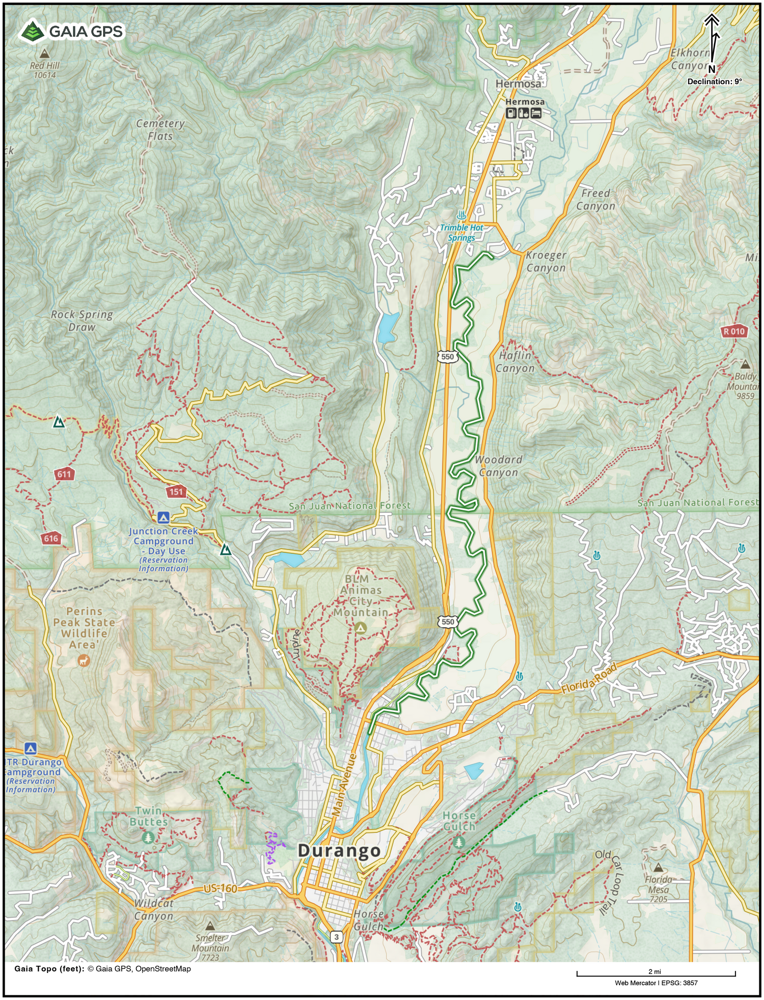
Lower Animas
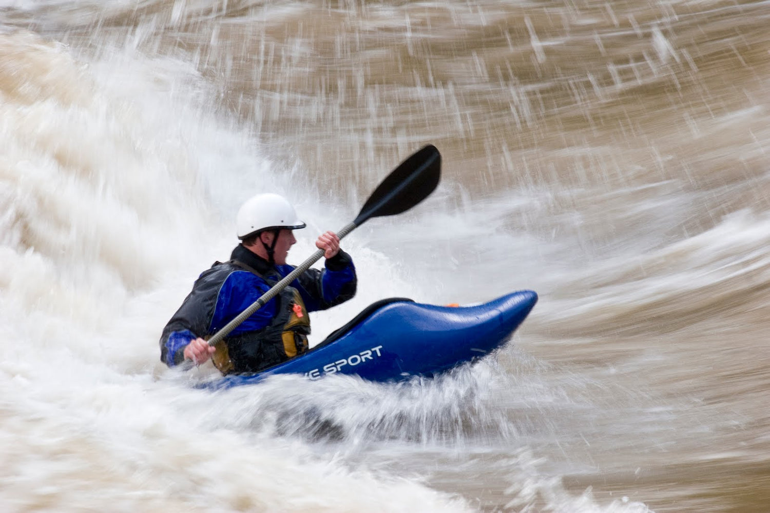
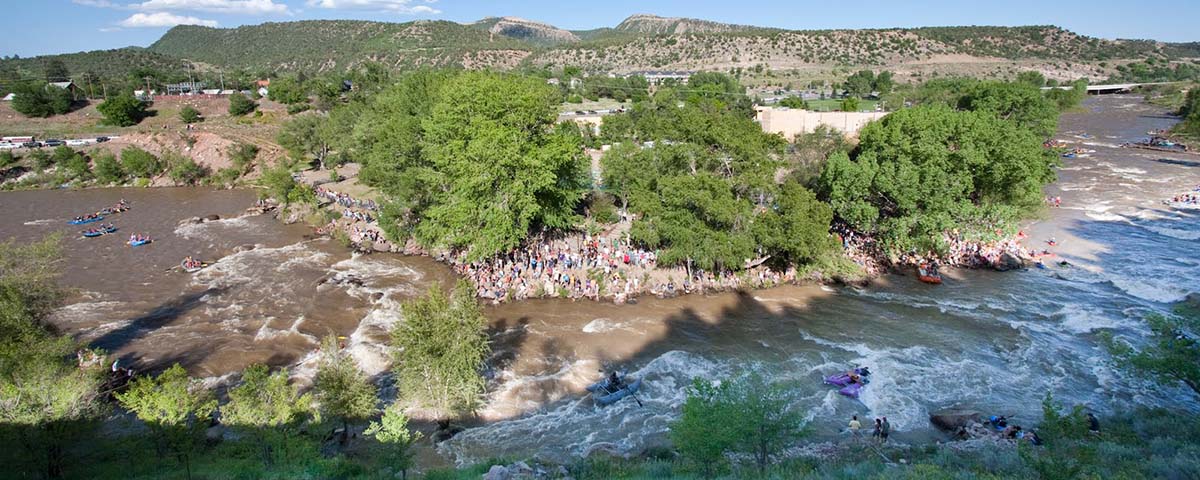
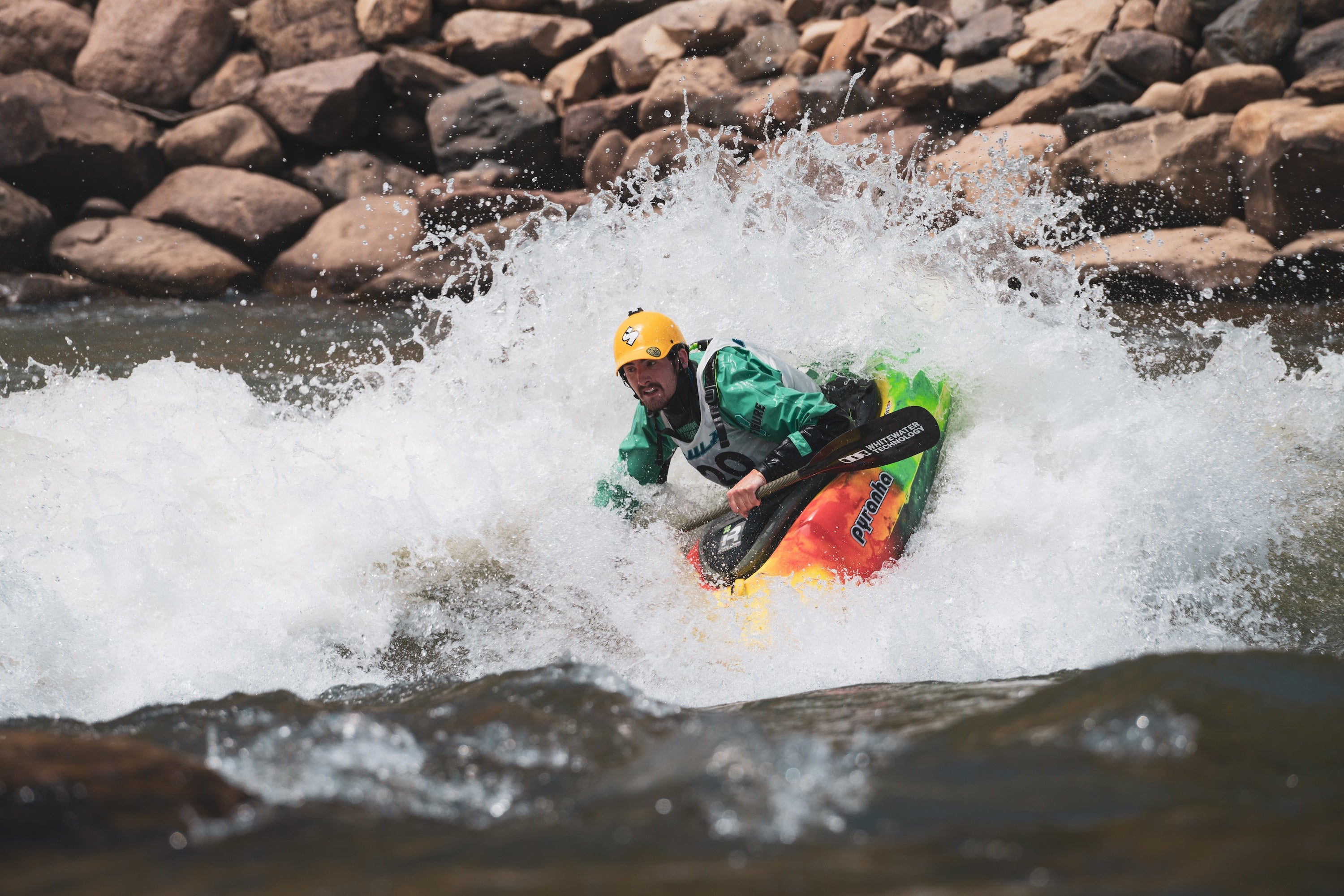
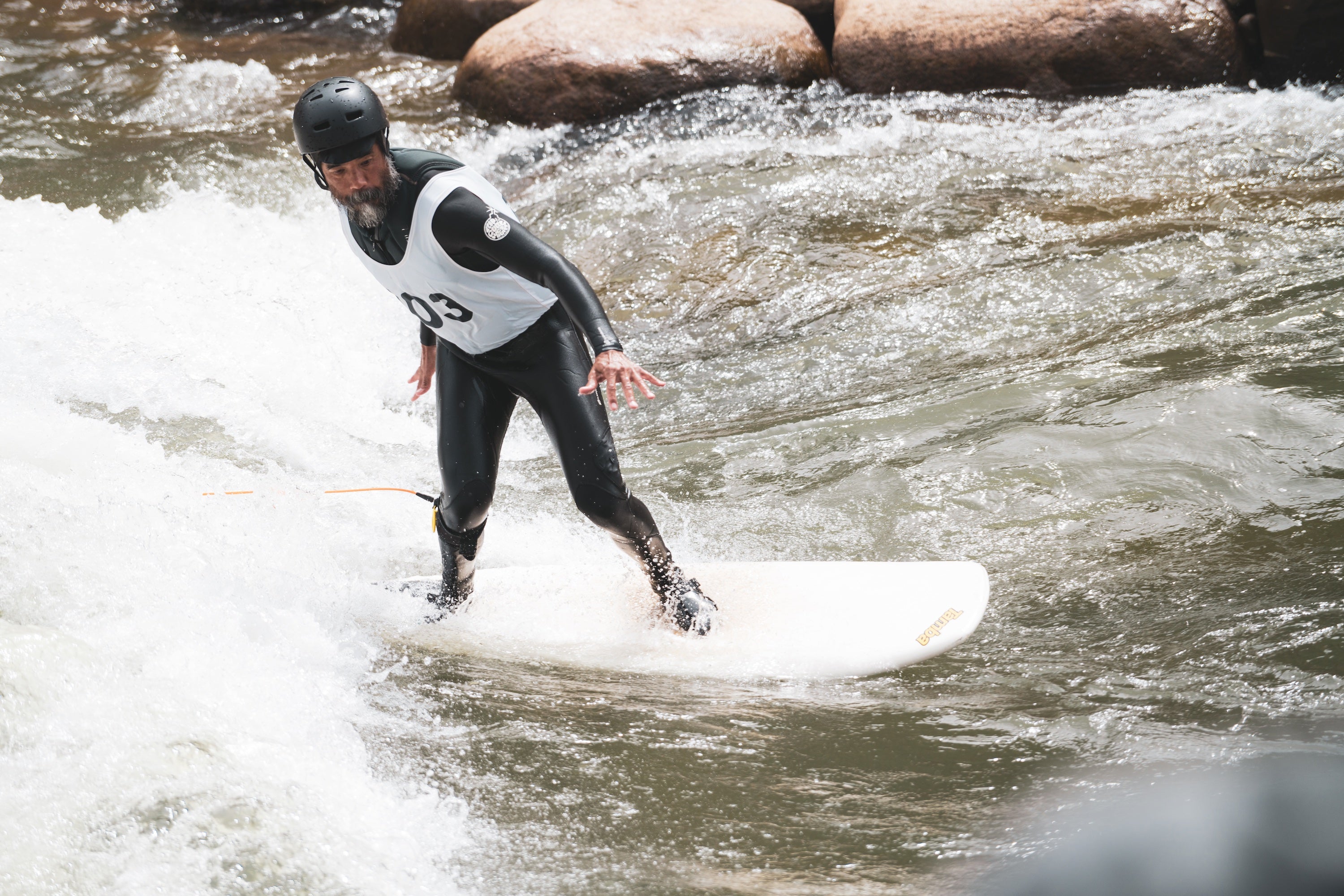
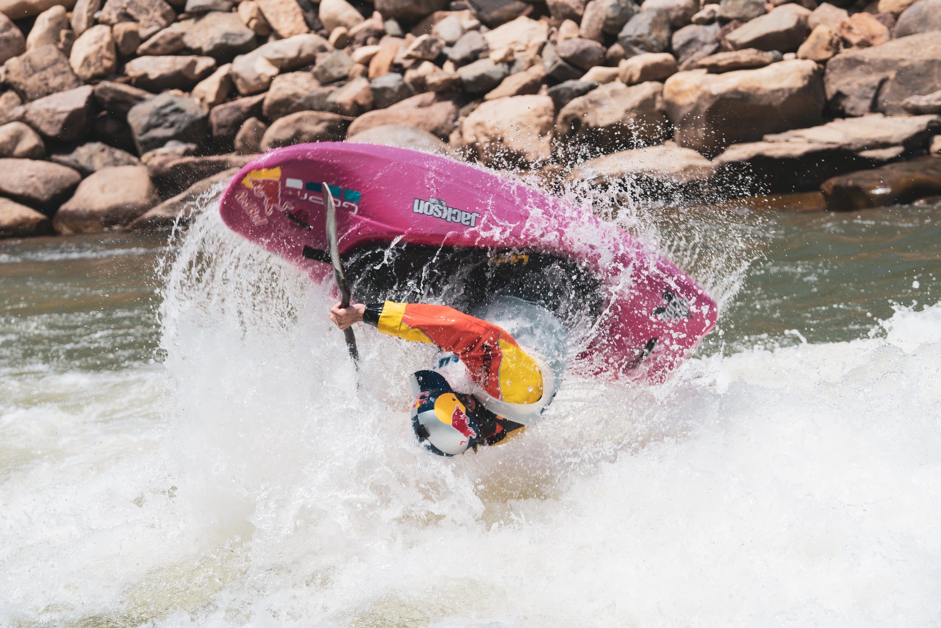
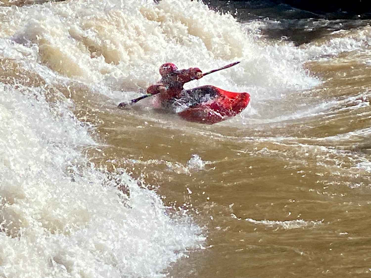
The Town Run has everything from moving flatwater to easy class II and III rapids, to world class playspots like Smelter, Corner Pocket, Ponderosa, Clock Tower Hole, Santa Rita Hole, Sawmill Waves, and Big Kahuna. Through the town run great surfing abounds during high water. A permanent Slalom Course is situated at Santa Rita Park through Smelter Rapid. Here, the Durango Whitewater Club has trained several US Kayak Team members. Several put-in and take out options exist, along with multiple park-and-play spots. There is a good manufactured play feature at the 29th Street Put-In.
In 2014, Durango’s Santa Rita Whitewater Park was revamped with more permanent, grouted-in features. In 2017, a water diversion structure was added at the very top of the whitewater park. We HIGHLY recommend scouting this feature at all water levels. At lower levels (below 1200cfs) it can be run on the far left. At Medium levels, it can be run down the middle and at higher flows (3000+) we recommend running far right. Beware the large hydraulics on river left at medium to high flows. This whole feature is very shallow and unnatural, so please use extreme caution when running it.
The first true whitewater feature is Smelter Wave, which is a fast and dynamic wave that can serve up big moves. At 3000-4000 this wave is world class. The river right eddy is very swirly and the river left eddy becomes very hard to catch at higher flows. Advanced kayakers will want to spend most their time here, while beginners will be happy to make it through upright.
The second feature is Corner Pocket. This was once the main playboat attraction, but has been changed to more of glassy wave that is more popular for river surfers. At higher flows this wave can get fast and rowdy and can be sticky at certain levels, or hard to stay on at others. Watch out for a reactionary feature (Captain Crunch) in the wave train just below Corner Pocket that can be munchy. River right eddy is the best.
The third feature is Ponderosa Wave. This is where you’ll find most beginner and intermediate kayakers, SUP and river surfers. At flows below 2000, this is a very friendly wave with a dynamic pocket on river right. 2000-3000 seem to be the sweet spot, with enough power to throw whatever moves you’re capable of, but with a friendly, forgiving feel. As the water comes up, Ponderosa starts to get bigger and more dynamic. Levels in the 3000+ range can get pretty sticky and this feature becomes a very large, river-wide wave hole at 6000+ that has been known to surf 16′ rafts for more than a couple minutes. River right eddy is small and hard to re-enter from at all levels.
The final feature in the park is Clocktower Hole. This feature only gets good at flows above 2000, but is still shallow in spots even at high flows. At 4000+ this is a very good feature, but be quick to hit the eddy or you’ll be hiking.
Below the park exist more on-the-fly surf and a few classic play spots like Santa Rita Hole (underneath the highway and walking bridge) which is good at levels above 2500 and excellent above 4000. This one can be a sticky mother, so be ready to get a little chundered and keep your shoulders down. Below this, Margarita Wave and the Sawmill Set become world-class (and arguably the best play in town) at flows above 5000. At the end of Sawmill lies Big Kahuna. This is a classic front surf wave that is an excellent beginner / intermediate surf spot at levels from 1500-2500. The eddy here can be tricky to attain.
Gauges:
4CRS Paddle School
CLASS IV-V
Upper Animas
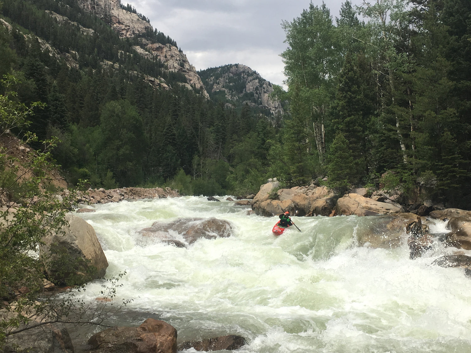
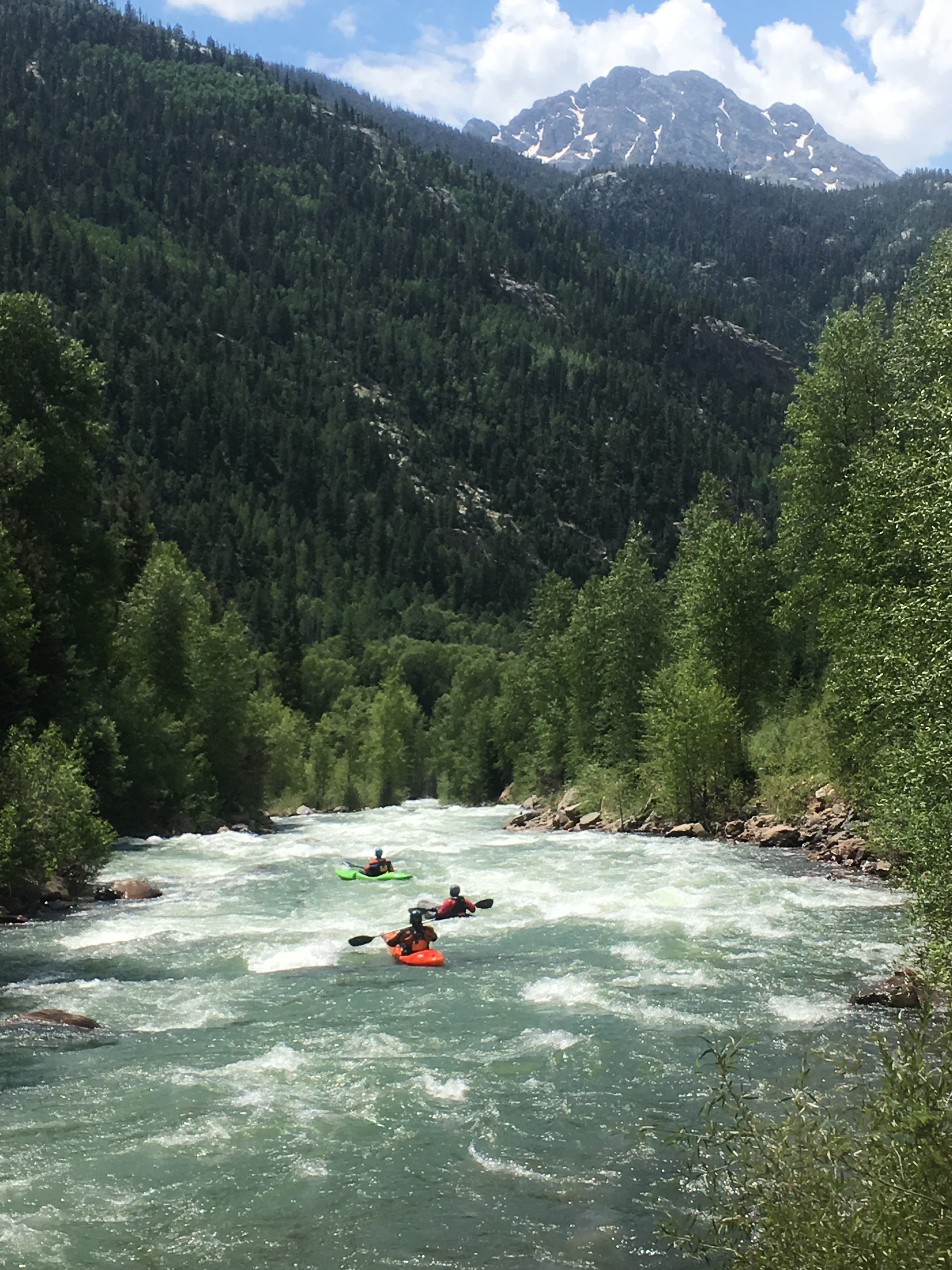
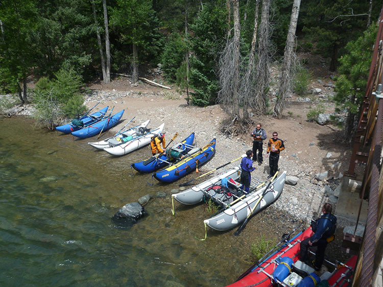
For advanced to expert level paddlers the Upper Animas River between Silverton and the bottom of Upper Rockwood Box is a Class IV to V paradise of stunning beauty and world class whitewater excitement. The run is long – 24.2 miles if taking out at the Tacoma power plant, or 26.8 miles if running through the Upper Rockwood Box – but the gradient is steep and the flow is fast.
Access is reasonably easy and the shuttle distance is almost equal to the downriver distance because US Highway 550 parallels the river along this section. Also shadowing the run is the Durango to Silverton Narrow Gauge Railroad Line, an alternative to self-shuttling.
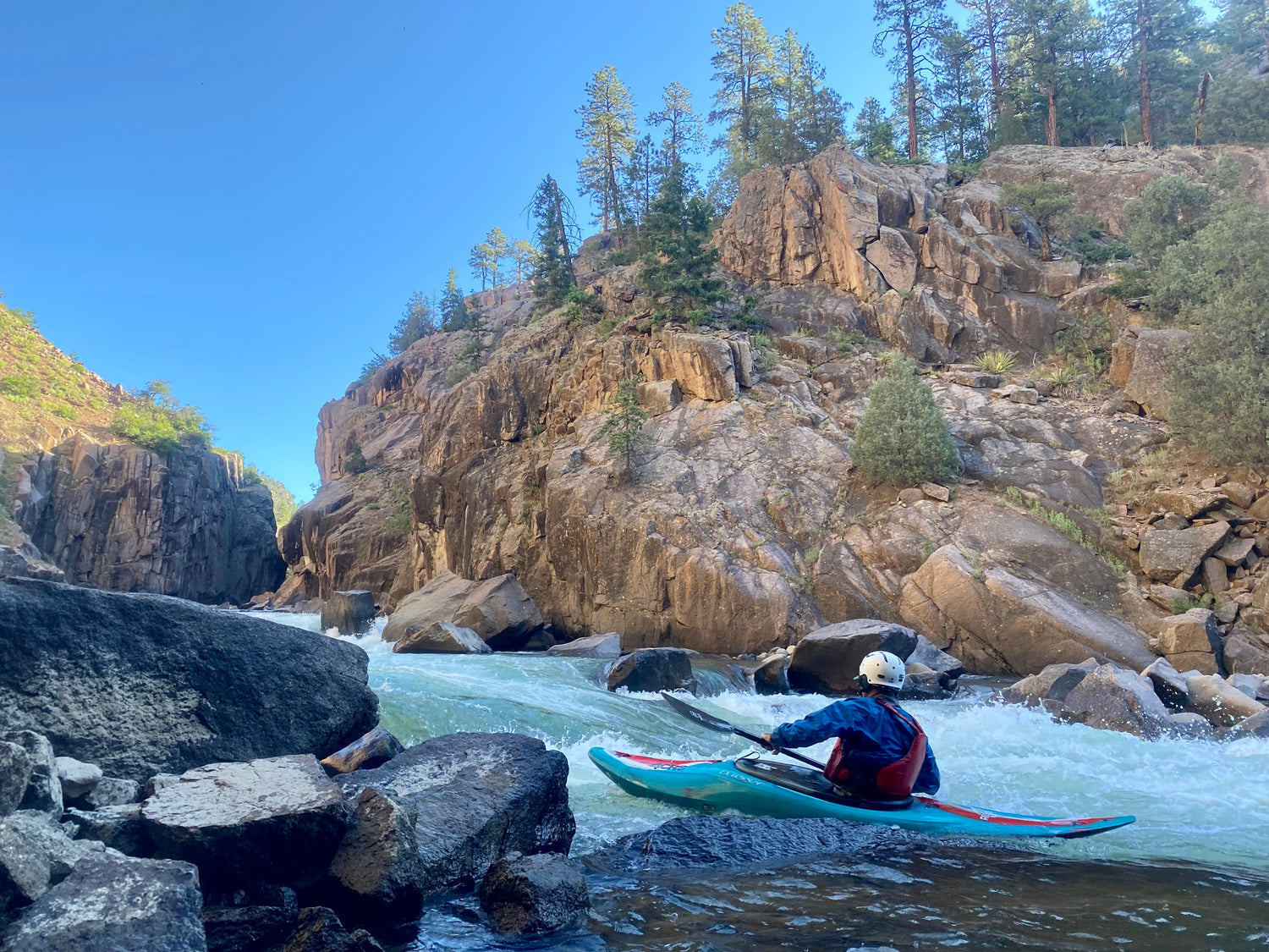
The Upper Animas begins at 9300′ in the town of Silverton. Weather can be chilly, and the water is always frigid. This is a Class IV-V run that should be approached with a solid Class V mentality because of the extremely cold water and very continuous nature of the rapids. At medium to high flows, there are several sections that are non-stop continuous Class III-IV for several miles without pause, some of which lead into Class V. Swims at all of the bigger rapids have proven to be fatal, so use extreme caution. Be prepared with extra supplies and emergency gear such as a breakdown paddle, extra clothes and food. Wetsuits and paddle jackets are a minimum, but drysuits are HIGHLY RECOMMENDED, and kayakers and open boaters should wear hand protection and skull caps (even if it feels too warm at the put-it. Trust us!) Rafters should take a complete repair kit. Bring every piece of layering you own, even if its sunny out. Please be aware that you cannot rely on Durango/Silverton Railroad as a means of emergency access (but please try to if you need help.) Please do not take this run lightly.
Water levels are considered Low: 500-1000 cfs, Medium: 1000-2000 cfs. High: 2000+ cfs. All flows given are as measured on the Animas Below Silverton gauge and are highly subjective. Be sure to check the Animas near Tall Timbers gauge, especially early in the season, to see how much flow the side creeks are adding, especially if considering running through Rockwood Box.
Put-in just south of Silverton the dirt road on the left off Hwy 550 just after crossing Mineral Creek.
Watch for a very low bridge with railroad debris soon after launching. At low to medium water kayaks can pass on far right, rafts may need to portage or risk a tear. There are good warm up rapids for next two miles. If you have any trouble here, now is the time to bail. Hike back to your car via the tracks. The rapids slowly get more difficult as you descend. A tricky drop with a large boulder on the right signals caution as ‘Snowshed’ (Class IV) is only 50 yards downstream. Look for a concrete wall on river left. Scout left. ‘Snowshed’ can be run right but must be punched with authority. Left is a tricker entrance but less consequential. After a short run out the river calms. Pass under the Elk Park footbridge.
‘Ten Mile Slide’ A short steep drop marks the end of Elk Park. You’ll pass under the rail road again and be prepared to scout river right shortly about 1/8th mile past the bridge. Here scout right at a pool on the edge of a marshy area. This one can easily sneak up on you, so be heads up. Look for a sharp right hand turn as the river hits a small vertical wall on river left. Kayakers may choose to round the corner to the edge of ‘Ten Mile’ rapid. Mt Garfield dominates the skyline to the left. Snowden peak is to the right and high above the canyon rim. ‘Ten Mile’ is one of the “Big 3” Class V rapids on the Upper and should be scouted by all unfamiliar with the run. Run left to right to center at the top and center left to center right through the bottom. Watch for an anvil shaped rock two thirds through the top section; its sticky and sharp! The next few miles below this rapid are very continuous Class III+/IV, so set safety below the crux and stay heads up for the next few miles.
The next major drop, ‘No Name’ rapid is the crux of the Upper Animas above Tacoma. It is tough to spot the proper scout landing if you are unfamiliar with the run. A recent landslide has created a new, shallow Class IV rapid just above No Name, making it even more difficult to line up for the crux move. (This rapid has cleaned up recently and is now mostly Class III, but the dynamic nature of the area may cause it to become more technical again).
Approx. 3 miles below Ten Mile, as you go through a slight left bend, watch for a group of large logs deposited on an island above the rapid (most of the current- 90%- is going right of the island). Debris from the rock slide can be seen on river right. Stop on the left or right when you see these and scout. Good trees on the left are ready for a boat tie-up and the train tracks on river right make for an easy scout. A good trail on the left is found in the brush and brings you directly to the bottom of the drop. There is an obvious left hand route in the meat of the rapid, but the entrance to it can be tricky with several exposed rocks (depending on levels) making it tough to line up. There is very continuous III+/IV whitewater for two more miles below No Name, including the Class IV Tank Rapid, so stay heads up.
‘Broken Bridge’ Rapid is obvious for it’s namesake. Watch for a broken metal bridge spanning the river. Rafts will need to find a good scout well above the bridge, while kayakers can grab eddies closer to or immediately after the bridge. Left side scout is a bit of a bushwhack in spots, but gives you a better view and a lines you up for a cleaner run. This is another long rapid characterized by large, crashing waves at the top and a nearly river wide hole at the bottom. The best line is often center left through the top waves with a far left sneak of the bottom hole. As usual, the class III+ continues for several miles below this drop.
From here things “mellow” out after Cascade Creek comes in on river right. Stay alert for Lunch Box and Dinner Gorge, two mini-gorges that give you a tiny feel for what Rockwood Box is like. Other random holes and rocks abound so stay alert.
The above describes only a few of the highlights of the run and should not be taken as an exact guide to running the rapids. There are miles and miles of whitewater on the Upper, too many to outline, and solid boating skills with prudent scouting are a must. Always stay alert when running the Upper. A guide is highly recommended for those unfamiliar with the run.
The Tacoma power plant on river right marks the end of the run for most. A ride out of the gorge can be arranged with the Durango & Silverton Narrow Gauge Railroad– 888-872-4607 or 970-247-2733. They can accommodate kayakers, rafts and gear, but reservations must be made well in advance. Hiking out along the railroad tracks would be a 3 mile trip and is illegal. There is a 1.5 mile legal hike-out to the right of the Tacoma farm house, up a steep gully that eventually deposits you at Haviland Lake. This trail can be difficult to route find near the top. When in doubt, go left.
Gauges:
Class IV-V
Rockwood Gorge
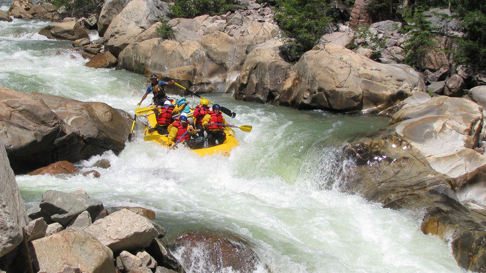
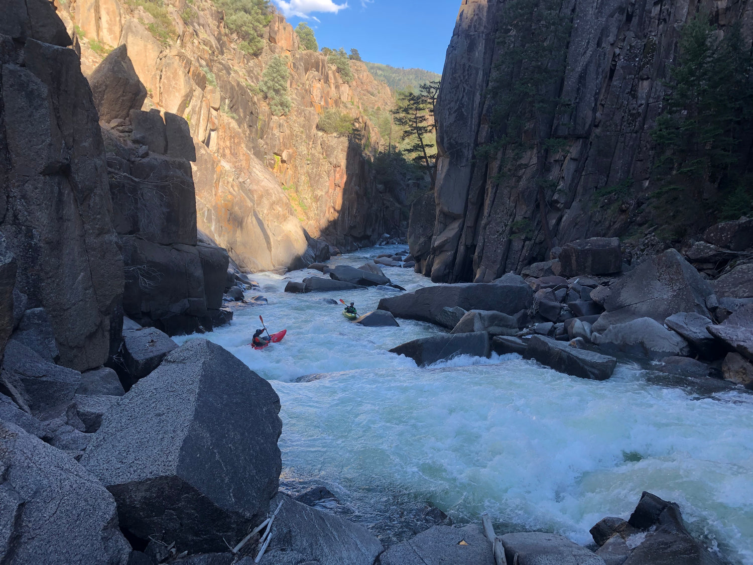
Expert Kayakers, and open boaters can continue downstream through the Lower Gorge to Rockwood. If you had any trouble on the Upper do not attempt the Lower Gorge. It is the hardest, most dangerous section of the Upper Animas, and comes at the end of a long, hard day. There have been deaths here. Rescue is difficult and all walls are vertical and undercut. There is little river bank scouting possible in the gorge and boat scouting is mandatory for those unfamiliar with the run or water level. The first and most significant rapid is ‘Mandatory Thrashing’. An often river wide hole that can cartwheel several boats at once (as witnessed by this author). Lower flows are run far river right against the wall. At high water there’s a line center left, but paddle like hell and tuck through the breaking diagonal. A scout is possible on river left, several hundred yards above the gorge entrance, with a healthy hike downstream and solid route finding skills. If you chose to scout from the train tracks, be quick and listen for the train. At levels from 1700-2200 on the Tacoma Gauge, Mandatory is very sticky and has been known to be a shoulder ripper. Swims here are long, so try your best to stay in your boat (and remember, float bags are for your friends!).
The gorge following stays tight with some spectacular sections. Boat scouting and read-and-run techniques are necessary here. When in doubt, this author says “stay left”. The bigger drops in here are Red Wall Rapid, The Guardian and Wall Slammer. The last rapid prior to the take-out contains a hole that has caught many unaware at higher levels. Scouting is possible on the lower drops of the Gorge. Don’t miss the take-out as the gorge below is truly un-runnable as it goes into an underground sieve. Look for the Forest Service take-out sign and exit river right. Hike out on the steep trail to the Rockwood Station where you have left your shuttle.
At low flows, Rockwood is our “off season” run. It is enjoyable down to approx. 275 cfs on the Tacoma gauge. At levels between 275 to 600 cfs Rockwood is Class III-IV, but should still be taken seriously, as it is a nearly inescapable vertical gorge in most places. Hiking in along the train tracks is illegal, so if you brave this run, only hike in early morning, mid-day around noon, or after the last train has passed around 4pm. Hike in at your own risk.
Gauge:
Class V+
Bakers Box
Bakers Box, also referred to as Pandora’s Box, is the most difficult stretch of runnable whitewater on the Animas River, and is one of the most difficult and committing pieces of whitewater in Colorado. This stretch of the river is contained in a vertical box canyon, with little or no chance of escape. Several of the rapids are unscoutable and unportageable. This highly difficult run is further complicated by no legal access, forcing paddlers to trespass across the private property of a gun-toting land owner before reaching the canyon rim, where a rappel or sketchy down-climb is necessary to reach the river. A guide is mandatory, not only for the whitewater but also to access the run without confrontation. Bakers Box is runnable from approx 300-1200 cfs (most will only run it from 350-650) on the Tall Timbers Gauge. The put-in is located below the “unrunnable” Middle Box (yes it does get paddled, but with an extreme portage around the sieve), while the take-out is located at Bakers Bridge. This run is NO JOKE. Please do not go without someone that knows the lines, as there is a high probability you will end up in a sieve.
Class I-II
Animas Valley
Below Bakers Bridge, the Animas finally mellows its steep descent from the peaks of the San Juans. This stretch is broken into two sections, the Upper Valley and Lower Valley. The Upper Valley stretch is Class II and starts at Bakers Bridge. This is carry-in access only, only suitable for small craft. From here down, there are approximately 8 river miles of Class II paddling to Trimble Bridge. Beware diversion channels.
The Lower Valley stretch features approx. 13 miles of flatwater paddling from Trimble Bridge to Oxbow River Park or 33rd St. Many people put in at Oxbow or 33rd and paddle up stream for training / workouts, before turning around and paddling back to where they put in.
Both of these sections are complicated by access and landowner issues. The only “legal” access points are Bakers Bridge, Trimble Bridge, Oxbow and 33rd St. Both sides of the river are private property for the entire Animas Valley stretch. Landowners are currently trying to shut down access to the entire Animas Valley because of trespassing by tubers and paddlers that underestimate the time needed to navigate either stretch. Please don’t exacerbate this situation by planning accordingly. Plan on approx 2 hours of paddling on the Upper stretch and 3+ hours on the lower stretch. There are no legal stopping points, and even standing on the river bed in-stream is considered trespassing. Please be respectful to any landowners you may encounter on either stretch.


